|
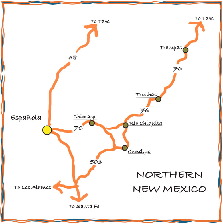
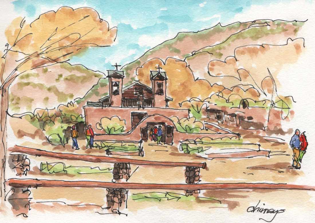
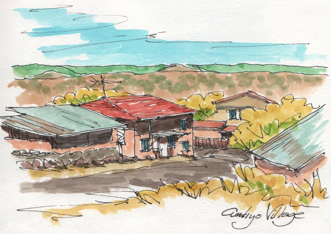
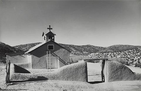
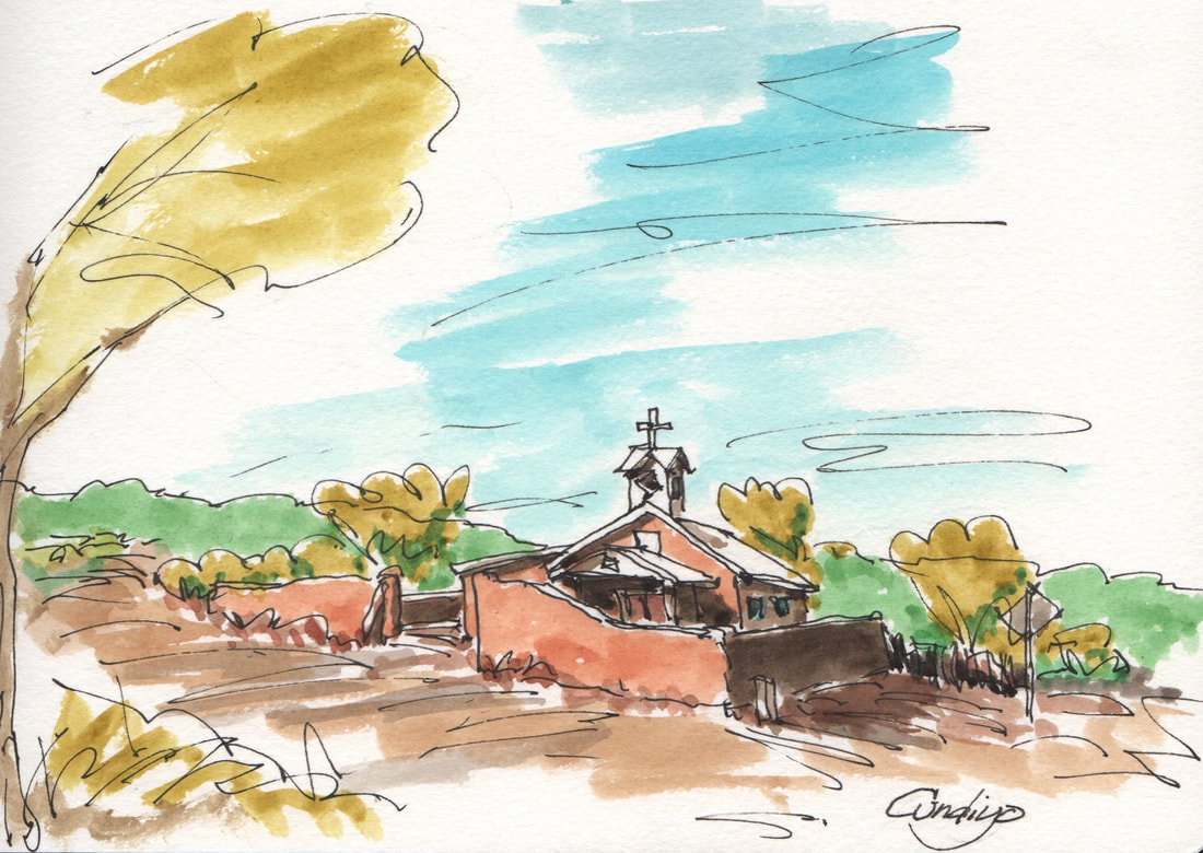
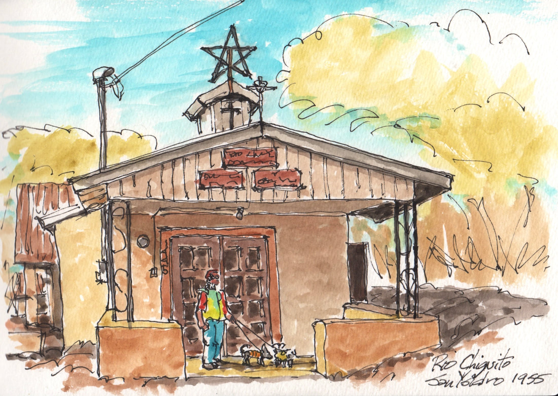
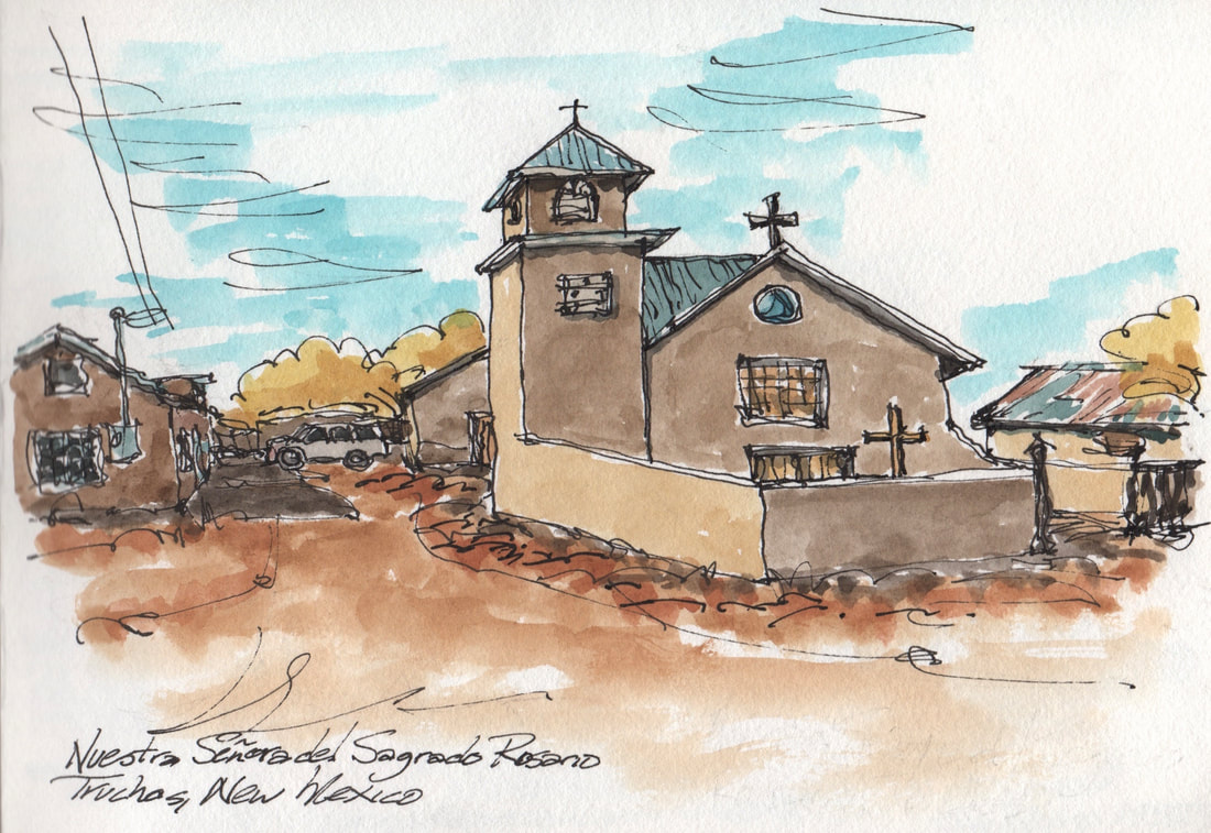
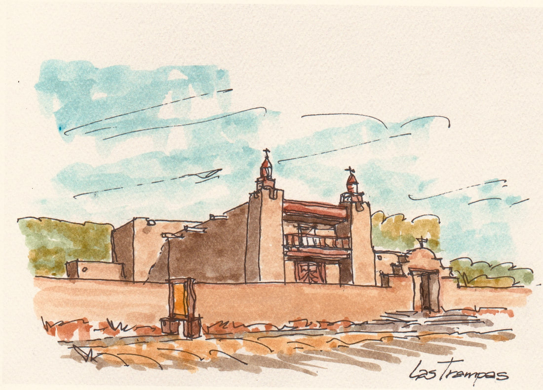
(Some descriptions provided by Wikipedia and various New Mexico tourist guide websites) During a short visit to Española, New Mexico for the annual Fiber Arts Festival, we spent a Saturday devouring a glorious breakfast at Rancho de Chimayo Restaurant followed by a drive north on portions of the High Road to Taos. The road is described as “a scenic, winding road through the Sangre de Cristo Mountains between Santa Fe and Taos…that winds through high desert, mountains, forests, small farms, and tiny Spanish land grant villages and Pueblo Indian villages.” In these villages are a collection of community churches reflecting long histories and resilient community spirits. A December 1, 2022 article in New Mexico Magazine, “Keeping the Faith for New Mexico's Historic Churches” lists a 1980s statewide survey that identified nearly 700 historic churches, of all denominations, not including private chapels and the moradas of the Penitente Brotherhood. Most were built before Anglo settlement in New Mexico. The article describes the challenges of preserving structures made of mud, stone, and timber. It also states that “New Mexico’s historic churches represent a unique architectural tradition. A few good souls aim to save these cultural icons from the sins of neglect…these churches are certainly among New Mexico’s most important monuments,” (says Spanish colonial scholar Robin Farwell Gavin). First and foremost, they’re parish churches. But they’re also important artistic and architectural examples. The fact that they’re there and being preserved—and that the community comes together to do that—tells you something about them. They were the center of the community, whether it was a Hispanic town or a pueblo. A lot of life events revolved around them.” And so we ventured out to see what we could find. First we stopped at the Sanctuario de Chimayo and then south to State Road 503 where we meandered through several villages and then east on State Road 76 which is known as the “High Road to Taos - a Scenic Byway". Here are my sketches of some of these villages and churches. Chimayó’s Plaza del Cerro – this is described as one of the last surviving Spanish fortified plazas in the southwest. Believed to be built on sacred earth with miraculous healing powers, Santuario de Chimayó is probably the most visited church in New Mexico. It certainly was the day we visited. As we meandered south past the Santa Cruz Reservoir to State Road 503, we came across the village of Cundiyo and the Church of Santo Domingo. The village has an enchanting small scale and the Church has been a focus for many artists and photographers including Laura Gilpin’s famous photo from 1945 which is now in the collection of the Amon Carter Museum of American Art, Fort Worth, Texas. As we drove further through several valleys, we stopped to let the dogs out in Rio Chiquito a small village just before State Road 76. We later learned that the village was founded in 1699 by the King of Spain as a farming community. However their charming little church of Sagrado Corazon de Jesus y San Isidro del Rio Chiquito was the newest church (and the longest name) we encountered – one of the three signs at its entrance listed the date, 1955. The small structure had a holiday star on its modest steeple. As we walked around, one of the villagers stopped to ask if we were OK. Evidently, this little 20th century church doesn’t receive many out-of-town/state visitors. Continuing northeast on the winding State Road 76, we drove up the ridge to the colony of Truchas looking for the Mission of Holy Rosary (Nuestra Señora del Rosario Mission Church). We drove straight through the village before realizing we were about to venture onto an unimproved forest road. Turning back, we realized the church was just off the main road. According to a website, A High Desert Journey: High Road to Taos, “Truchas was established by a royal land grant in 1754 with settlers from Chimayó and Santa Cruz (near Española). It was built as a walled compound around a plaza to create a buffer between other Spanish settlements and the nomadic Apache and Comanche bands who often raided both Spanish villages and Indian pueblos…the settlers of Truchas hand-dug miles of acequias (irrigation ditches) to bring water from the trout-filled river that gave the town its name (Río de las Truchas means "river of trout"). Although today's residents still work their farms, many also commute to jobs in Santa Fe or Los Alamos. A few still make their living as traditional craftspeople alongside the many outstanding Anglo artists and galleries that have been drawn to Truchas and its magnificent mountain views.” The church was built around 1805 and was featured in the Robert Redford movie “The Milagro Beanfield War” based on the novel by John Nichols about water, politics, and culture in a small community in Northern New Mexico. Descending the Truchas ridge we arrived in Las Trampas. At the center of the village is the impressive San Jose de Gracia church. Still in use after nearly 250 years, the church and patio walls had received a recent coat of mud plaster with chopped straw. “The village was founded in 1751 by a royal land grant, entitled Santo Tomás Apostol del Río de las Trampas ("Saint Thomas, Apostle of the River of Traps"). Despite the heavy toll taken by a smallpox epidemic and raids by Plains Indians, the village survived and the settlers managed to build the magnificent San José de Gracia Church completed in 1776. The church is considered a model of the Spanish colonial church architecture found throughout New Mexico. It has lovely reredos painted by well-known santeros. The church is a National Historic Landmark, and the village is a National Historic District. The building across from the church with the little bell tower was the school.” We then headed back to Española through the Picuris Pueblo – undoubtedly skipping past many more of these remarkable historic villages and churches.
2 Comments
This is a surreal time. As news agencies start talking about WWIII, I recall our childhood school days of “duck and cover”. Nothing seems to have prepared us for the chaos we are experiencing and the dark days that seem to be advancing. There is no simple response other to continue living our lives as normally as possible while supporting the various causes that offer some sense of hope. For Ukraine, a country that most of us have never visited, our polarized country seems to be unified in our disgust of Putin’s invasion while admiring the Ukrainian people and leadership. At a personal level, I have sought solace in attending a local rally for Ukraine and visiting on-line images of Ukraine’s heritage and history. The current images of devastation, injury and death are too much to fathom, so I’ve taken another approach to learn more about Ukrainians and the country they are defending. First, I’m sharing some sketches from a recent rally here in Tucson organized by the vibrant and passionate local Ukrainian community. It is inspirational to see a community in Tucson that has maintained their language, their culture and passion for their homeland while also being strong members of the Tucson community. They have much to teach the world. I’ve also journeyed on-line looking for travel snapshots that showcase some of Ukraine’s historic places. Some are from tourist postings and some are from Ukrainians who are simply proud of their heritage. They all show some of what every Ukrainian is passionately defending. Sketching these places has enriched me with a reminder of how meaningless wars are at solving anything. With each sketch, I see places and spaces that draw me into an extraordinary community that is suffering needlessly. Hopefully we will soon see an end to the mindless devastation that has hurt so many people. Pima County and Tucson Stand with Ukraine – March 6, 2022Ukraine’s on-line heritage – a few places that inspired some rough sketchesSt. Andrews Church on Castle Hill in Kyiv - according to several sources, the church has foundation problems due to its position on the hill with recent cracks and new concerns that the church may collapse. Enduring a war and nearby explosions is probably not helping to preserve one of the capital’s prominent historic sites. Rynok/Market Square and the Neptune sculpture in historic Lviv - a central square of the city planned in the second half of the 13th century. In the four corners, there are fountains—wells from 1793, with sculptures representing four Greek mythological figures: Neptune, Diana, Amphitrite and Adonis. The Market Place, together with the historic city center of Lviv, is recognised as a UNESCO world heritage site. In recent news from a NY Times posting by Ivor Prickett, “for millions of internally displaced people, Lviv is the gateway to safety, however fleeting, in the west.” Armenian Street in Old Town Lviv – this street in the Armenian Quarter of Lviv was a refuge in the middle of the 13th century as Lviv has again become a refuge for those evacuating the invasion in other parts of Ukraine. Monastery of the Caves, Kiev - As one of the seven wonders of Ukraine, this complex goes by many names (Pechersk Lavra) and is an active monastery and significant historic site. It is also another of Ukraine’s UNESCO World Heritage Sites. It is maddening to think of an active invasion taking place around Kiev/Kyiv.
Thanks to those who have shared their photos. After doing these interpretative sketches, I hope that soon we can visit some of these places and the people who are defending them.  A sketch postcard – Wales 2013 A sketch postcard – Wales 2013 As the Coronavirus (Covid-19 virus) has shut down leisure travel for the foreseeable future, I’m thinking back to some coastal walk trips. Besides some of the spectacular settings, an iconic feature of these seaside walks was the occasional lighthouse. These stalwart towers from a bygone era still attract many visitors who relish their history and, for those fortunate enough to enter them, a spectacular view out over some incredible and often treacherous seascapes. While lamenting the travel prohibition and the inability to do travel sketches, I decided to look back over nearly 40 years of my sketchbooks to see if I could find some of my past lighthouse sketches. There were a few starting with a 1994 sketch of the Newhaven Harbour Lighthouse at Leith outside of Edinburgh, Scotland. This was surprising, since I grew up in the shadow of Nobska Light and behind the Coast Guard base in Woods Hole on Cape Cod. It looks like I never got around to sketching Nobska Light until 2002. Most of the lighthouses I sketched were simply seaside structures that just happened to be on our coastal paths. A few had historical significance, but many are no longer navigational guides. However, all the sketches of lighthouses recall a series of travels along some magnificent coasts that continue to beckon me. SCOTLAND - 1994 Leith Lighthouse – Newhaven Harbour, Leith, Scotland: Recently illuminated after being dark since 1930. No longer a navigational guide, the 19th century tower was prefabricated in Edinburgh by James Dove & Company in 1869 and now serves as a community historical landmark for the port villages of Northhaven and Leith near Edinburgh, Scotland. We visited the village of Leith while staying in Edinburgh for Lindy’s Plant Pathology Conference at the University of Edinburgh in 1994. DENMARK - 2001 Skagen Lighthouse - an active lighthouse just northeast of Denmark’s northernmost town of Skagen in the far north of Jutland, Denmark. It started operation in 1858, replacing an earlier 1747 lighthouse which was Denmark’s first brick lighthouse. The current lighthouse is unpainted brick with an attached two-storied keeper’s house painted in bright yellow. We visited this area while on a tour of Denmark and stayed in Lindy’s cousin’s “sommerhus” while we were in Skagen during the summer of 2001. WALES - 2013 Strumble Head Lighthouse - on Ynys Meicel (from Welsh: St. Michael's Island), also known as Strumble Head, a rocky island at the northwest corner of Pencaer area, five miles west of the town of Fishguard, in northern Pembrokeshire, Wales. The present lighthouse was erected in 1908 and replaced a light-vessel previously moored in the south of Cardigan Bay. The circular stone tower is 55 ft high and still contains the original Fresnel lens lantern. The lighthouse was reached by an iron bridge with a pipe handrail on the bridge that siphoned fuel from the mainland.  This section of the Wales coast called “Strumble Head - Llechdafad Cliffs” was a spectacular section of our Wales Coastal Walk in Pembrokeshire, South Wales. We walked this coast in August 2013 and took some extra time from our hike for lunch and some sketches. According to the sketch, we ate a Scotch Egg and Welsh Cakes - probably with an Ale. The area is designated as a "Site of Special Scientific Interest" (SSSI) in an attempt to protect the fragile biological and geological elements. CALIFORNIA - 2018 Point Arena Lighthouse – located on a peninsula that juts out a ½ mile from Point Arena (“sand point”) in Mendocino County, California. The first Point Arena Lighthouse was constructed in 1870 to guide ships around the sandbar. Located very close to the San Andreas Fault, it was heavily damaged by a devastating earthquake in 1906. The brick tower was replaced by a steel reinforced concrete tower by a company that normally built factory smokestacks. It was the first lighthouse to be built in this manner. The lighthouse featured a “1st Order Fresnel Lens”, but of course the six foot diameter six ton lens has since been replaced by a 40 pound LED light. The original lens is now in the Lighthouse museum adjacent to the tower.  We visited the lighthouse while visiting our friends, Bill & Darcy Shaw, in Gualala and our cousin, Paul Andersen, in Point Arena. The lighthouse has a wonderful museum and also has adjoining apartments where you can stay. We were fortunate to attend an evening full-moon tour which included a climb up to the top of the lighthouse tower with a guide who provided an informative talk while we gazed out at sea. MICHIGAN - 2018 “Big Red” Holland Harbor Lighthouse – is located at the entrance of a channel connecting Lake Michigan with Lake Macatawa that connects with the city of Holland, Michigan. This 1907 structure has a gabled roof that reflects the Dutch influence in the area which was settled in 1847 by Dutch Calvinist separatists. The three-story square tower building is topped with a gray-shingled roof, and is one of the most photographed lights in Michigan. We visited the lighthouse in September 2018 while touring this section of Lake Michigan with Dale and Susan Frens who originate from this area.  Grand Haven South Pierhead Lighthouse – there are two lighthouses on the south pier of Grand Haven, Michigan where the Grand River enters Lake Michigan. Established in 1839, the two lights are connected by a catwalk that also connects them to the shore and the Grand Haven Boardwalk. The inner light is the cylindrical tower, and the foghouse outer light stands on a huge concrete foundation. The lighthouse pier is a popular spot for fishing and catching the sunset and is claimed to be one of the most photographed lighthouses in the Midwest. Like many of these lighthouses, it was deemed excess by the Coast Guard and is now managed by a community group to care for the structures.  Little Sable Point Lighthouse – This lighthouse was the third lighthouse developed on Lake Michigan’s eastern shore. It’s history notes that Congress appropriated $35,000 for the lighthouse in 1872 on over forty acres of public land set aside by President Ulysses S. Grant. It required more than 100 wooden piles driven into the sand to support the foundation for the tower on the sandy soil of the Point. A cofferdam was then built in the sand so that the ground water could be pumped out and cement could be poured for the foundation. The 100-foot brick tower has a decagonal lantern room to house a “third-order Fresnel lens” that had two lower fixed sections with a rotating upper section. As with many of these 19th century lights, it required the keepers to wind up a weight that was suspended between the tower’s inner and outer walls which powered the revolving mechanism. In 1926, the lighthouse was sold to the State of Michigan and is now part of the Silver Lake State Park. While we couldn’t get into the lighthouse tower, but we did enjoy our time in the sand dunes of the park.  Manistee North Pierhead Light - located on the north pier in the harbor of Manistee, Michigan (Lake Michigan’s “Victorian Port City"). It was preceded by a light on the south pier in 1870 which burnt in the Great fire of 1871, along with the town of Manistee which coincided with the Great Chicago Fire, the Peshtigo Fire in Wisconsin, and fires in Port Huron and Holland, Michigan. This tower was constructed of cast iron around 1927 and had a “Fifth Order” Fresnel lens. We walked out on the cast iron catwalk to the tower during a blustery wind. Evidently this catwalk is one of only four that survive in the State of Michigan.  Grand Traverse Lighthouse - located at the tip of the Leelanau Peninsula, which separates Lake Michigan and Grand Traverse Bay – or as our friend Chris Kehl, a former resident of Northport, would say “this is the pinky of the Michigan mitt." The 1858 structure is listed in the National Register of Historic Places and is very popular for tours of the restored lighthouse and the lower keeper's home which has artifacts from the 1920s and 1930s. Evidently you can reserve a stay to serve as a keeper. We enjoyed visiting the many exhibits on area lighthouses, foghorns, shipwrecks and local history which are located in the adjacent Lighthouse and Fog Signal Building. ISLE OF WIGHT, ENGLAND - 2019 Henry the VIII’s 1544 Southsea Castle – this lighthouse is not actually on the Isle of Wight, but in Southsea, Portsmouth where the ferry leaves for the island. This complex formed part of the King's Defense program to protect the coast of England against invasion from France and the Holy Roman Empire. Over the years, it has served as an artillery fort, a military prison, and in 1828 the Admiralty constructed a lighthouse. It is now restored to its pre-1850 appearance and is a popular tourist attraction with a museum and grounds that are part of the Portsmouth (England) Southsea Commons. We were in Portsmouth in the summer of 2019 prior to our coastal walk around the Isle of Wight which is just off the coast of Portsmouth. Since I had neglected to pack my usual watercolor kit, this sketch was done with some very cheap paper and some very poor Chinese watercolours found in a discount stationary store in Portsmouth. Fortunately after we got to the ferry port town of Ryde on the Isle of Wight, I was able to find an art store that sold Winsor & Newton supplies.  Needles Lighthouse - the lighthouse is an active 19th century lighthouse on the outermost of the chalk rocks at “The Needles” on the Isle of Wight. It was completed in 1859 and replaced an earlier light tower on top of a cliff overhanging the bay, which guided ships making their way up the Solent (the strait that separates the Isle of Wight from the mainland of England). This vista was a short walk from Totland which was one of our stays while walking the coastal path of Isle of Wight and signifies the transition to the “Back of the Wight” which is a more open and rural portion of the island. CAPE COD - 2002 Nobska Lighthouse - originally called “Nobsque Light”, is located near the division between Buzzards Bay, Nantucket Sound, and Vineyard Sound in the settlement of Woods Hole, Massachusetts on the southwestern tip of Cape Cod, Massachusetts – where I grew up while attending the Woods Hole School and later working as a scientific illustrator in the Graphic Arts Department of the Woods Hole Oceanographic Institution. When I was living in Woods Hole on Juniper Point behind the Coast Guard Base, my bedroom was on the top floor of a three-story house which had a magnificent view of Martha’s Vineyard Sound - and of course this wonderful lighthouse. I recall the reassuring effect of the lighthouse beams shining in my bedroom while also listening to the low bellow of the fog horn. The light station was established in 1826, with the tower protruding above the keeper's house, and was replaced in 1876 by the current 42 foot tall iron tower. The light station was added to the National Register of Historic Places in 1987. I recall the Hindley family who were light keepers in the 1960s and 70s and who may have been the last civilian lighthouse keepers in New England. The lighthouse and grounds are now managed by a non-profit, the Friends of Nobska Light, which conducts tours of the tower while renovating the Keepers House into a Maritime Museum.  At the time of these sketches around 2002, I was not doing watercolors, so I’d like to return to try a few watercolors and hopefully tour the new museum. The lighthouse commands a spectacular site and means a great deal to all of us who spent time in Woods Hole. A "post update" I've received numerous wonderful comments from various readers of this post including one from "Mary" who shared her 1963 sketch of Sankaty Head Lighthouse on Nantucket Island. Above the sketch is a vintage postcard of the light in its original position before being moved farther away from the cliff edge and when the Keeper's house was still there. Everyone loves a lighthouse! If any reader wants to share their favorite sketch of a lighthouse, please send me a note or comment to this blog.  "Ranger Bill" capturing a hedgehog cactus in Organ Pipe "Ranger Bill" capturing a hedgehog cactus in Organ Pipe Our long-time “gang” member and tour leader, “Ranger Bill (aka Dr. William Shaw, the renowned wildlife biologist) and his wife Darcy recently led the other members of our “gang” on a short trip to see the remarkable Sonoran Desert World Heritage site, El Pinacate and Gran Desierto de Altar Biosphere Reserve in Mexico with an overnight in one of Arizona’s oldest mining towns, Ajo, Arizona. Although the Pinacate reserve was our primary focus, our overnight stop in Ajo was a surprisingly rewarding destination. The old 1916 Ajo plaza which is one of Arizona’s great public squares has been restored, and the 1916 Curley School campus which looms up to the west of the plaza is now the home for the “Sonoran Desert Conference Center”, the “International Sonoran Desert Alliance”, a community garden, and numerous artists’ lofts and work spaces.  Sonoran Desert Conference Center, Ajo Sonoran Desert Conference Center, Ajo We stayed at the Conference Center in rooms that were tastefully converted from the old classrooms and featured light fixture sculptures created from the old classroom fluorescent light fixtures and many other touches recalling the old classrooms. Although we only had a short time in Ajo, I managed a few sketches of the Curley School entrance, its stately dome, and the entry balcony with an owl sculpture to oversee the entering students. The school was full of scuplture and educational inspirations as a majestic reminder of Ajo’s glorious mining days.  Ajo plaza train station - now the Ajo Visitor Center Ajo plaza train station - now the Ajo Visitor Center While waiting for breakfast, I managed to sneak in a quick sketch of the Tucson, Cornelia & Gila Bend Railroad station at the east end of the Ajo plaza while chatting with the plaza caretaker who was rightly proud to be a native of Ajo with employment on the town’s plaza. After breakfast, we stopped at the Ajo Chevron & Food Mart, El Cobre Deli (named after Ajo’s copper mining history), which is known for their homemade burritos. The display of these infamous burritos at a gas station was worthy of several sketches, but we were anxious to get to the Pinacate reserve so that we could be sure to have a campsite for the evening.  Centro de Visitantes Schuk Toak Centro de Visitantes Schuk Toak It was a relatively quick trip from Ajo across the border to the Reserve’s entrance just south of Sonoyta on Federal Highway 8 on the way to “Rocky Point” (Puerto Penasco) - where most of the traffic of the massive American RV’s were headed. Before entering the Reserve, we stopped at the new Visitor Center (“Centro de Visitantes Schuk Toak”) just a few kilometers further south on highway 8. The building is an extraordinary self-sustaining building in the middle of a lava field which is worth the short visit to see the numerous introductory exhibits for the Reserve.  The "Gang" at Elegante The "Gang" at Elegante Although Arizona did not get very much winter rain this year, the Mexican Sonoran Desert must have received some recent moisture resulting in an impressive show of yellow brittle bush flowers and red blooms crowning the ocotillo plant. As we drove further into the volcanic areas of the Reserve, the black cinders covering the landscape and the exuberance of spring flowers provided a striking contrast between the harsh land and the ephemeral seasonal flower display. It was difficult to resist stopping every few feet to try to capture the splendor on camera and in watercolours. Our first stop was the Elegante Crater, where I foolishly tried to capture the entire crater landscape in a single quick sketch.  Fellow gang member Karen Wood took a picture of my effort to capture this immense crater. Her photo does a better job of showing the scale of the crater. Frustrated with the difficulty of sketching the crater and annoyed with my travel water brush that kept drying out too quickly, I tried to take in another scene while sitting in the shade of a Palo Verde tree.  After touring a bit more, we drove to our designated camp in Tecolate where we hiked up the cinder hill and then we settled into an evening under the stars. Fellow gang member, astronomer, and expert photographer Steve Larson took a sunset shot of me sketching our camp from on top of the cinder hill. He then took another one of me walking back to our camp amongst the yellow brittle bush and ocotillos. I wish my sketch was as successful as Steve’s photos.  After cocktails, Bill and Darcy provided a gourmet meal of turkey chili, cornbread, salad, and a decadent dessert of salted caramel bars. With the sun over the crater, Lindy amused us with her “Star Walker” phone app while Steve Larson provided further commentary on clear evening sky. With Lindy still playing with her phone app, everyone else scrambled off to bed rolls inside their cars while Lindy and I enjoyed the evening sky outside on our luxurious folding cots.  Tecolate Campground companions Tecolate Campground companions The next morning, I wanted to try to avoid yesterday’s sketching mistakes and tried a more modest sketch of the organ pipe cactus and ocotillo plant that kept me company during the night. This simpler subject was a much more satisfying way to start the day. We then drove through a stand of regal saguaros amongst the brittle bush on our way to the Cerro Colorado Crater. Although I desperately wanted to stop and sketch this, I had to fabricate the sketch later from memory which is far less rewarding than sketching in place. We drove to the top of the Cerro Colorado, and I was again faced with a massive scene to capture. This time I tried not to paint the entire crater and surrounding landscape. I think I managed to stop in time to keep the image from becoming too muddy. It was certainly a less frustrating approach and allowed for more interpretation within the lines.  A shady sketching spot - photo by Karen Wood A shady sketching spot - photo by Karen Wood Later while the others hiked, I again tried to capture the entire Cerro Colorado from the crater’s base in a shady spot – my efforts were again captured by Karen. My last sketch of the trip was perhaps my most ambitious as I tied to insert the gang hiking toward the crater. No matter how hard I tried to simplify the sketch, I couldn’t resist drawing the entire conical shape, but did manage to leave out enough to allow for some white paper to remain between the lines. I started this trip hoping to capture a magnificent landscape in a few sketches, but found that the Reserve’s grandeur was a bit more challenging for me. The experience did remind me to keep looking for the essence in a place and not try to put everything into a watercolour travel sketch.  Finishing a sketch with my audience at the Jama Mosque in Delhi, August 2015 Finishing a sketch with my audience at the Jama Mosque in Delhi, August 2015 We recently went to India on a Yale Educational Tour led by Professor Paul Freedman who specializes in (among other things) the history of cuisine. While the focus was spice, the tour was wide-ranging introduction to India. It started in Chennai where the East India Company originated and ruled the beginnings of the British Empire, then to the hill station of Munnar in the southwestern Indian state of Kerala with all of its tea plantations, then down to Thekkady home of India’s largest wildlife sanctuary (the Periyar National Park), then further down toward the Malabar Coast to a houseboat tour of the amazing Kerala backwaters. After two days of luxurious cruising in the waterways, we then completed our Southern India tour in the port city of Kochi where most of our tour group departed. Our family continued our tour with a flight north to India’s golden triangle to experience the three destinations of this tourist route: India’s capital city Delhi; Agra the home of the Taj Mahal and the historically significant Red Fort; and finally to Jaipur the capital and largest city of the Indian state of Rajasthan, known as the “Pink City” with its orderly networks of gridded streets laid out by the Bengali Brahmin architect Vidyadhar Bhattacharya in 1727. Between our tours of India’s many palaces and monuments we were treated to amazing feasts of India’s regional cuisines, the spices that lured so many colonial powers to India, evening lectures from Professor Freedman, and the expertise and hospitality of our guides Radhika Gopal in the south and Rashid Latif in the north.  Sketching at the Taj Mahal, Agra - August 2015 Sketching at the Taj Mahal, Agra - August 2015 Trying to capture some of this adventure in quick sketches and watercolours proved especially challenging, but as stated in the title, I knew that my modest travel watercolour kit probably needed a few more colours than the dozen trays I normally use. So my first step to prepare for the trip was to upgrade my travel watercolour kit to a 24 colours kit - the “Sakura 24-Piece Koi Field Sketch Set”. For this trip I also brought a couple Sakura waterbrushes (a large wedge brush and a medium brush) so that I wouldn’t have to fuss with a water container, and three Stillman & Birn Beta Series sketchbooks (5-1/2” x 8” 270 gsm white Cold Press).  Kapaleeshwarar Hindu temple - Chennai Kapaleeshwarar Hindu temple - Chennai Many of the tour sites proved formidable challenges for sketching, such as the exuberant Kapaleeshwarar Temple of Shiva with its innumerable statues on a pyramid shaped tower of bulls, elephants, peacocks, goat, parrots, flowers, and gods and goddesses. The only way to quickly capture most of these scenes was with a quick ink sketch of the key elements and then an impressionist splash of colour to imply the overall spirit of the scene. While doing many of these sketches, I often stood out in the midst of tourists taking pictures with their smart phones, so it did not take long for a small audience to gather. Most of them took pictures of me and offered very kind words of encouragement while sketching. These moments became some of my very special memories of the trip. For a country as vast and historically rich as India, it was certainly difficult to write or draw enough to reflect the magnificence of the country in only a few weeks. I also took many pictures on my phone, but these quick travel sketches best reflect my joy to being introduced to just a few of the treasures of India. For more details of the trip, download: India 2015 trip summary |
Archived storiesArchives
December 2024
Categories
All
Please subscribe!Enter your email address to receive Blog updates,
We love comments!Please send us a comment by clicking on the "Comments" at either the top or bottom of the Blog entry you want to provide comments. |


 RSS Feed